Wrestling with Balsam Ridge manway March 31, 2013
Posted by Jenny in bushwhacking, hiking, nature, plants, Smoky Mountains.Tags: Balsam Ridge manway, Bradley Fork, Cabin Flats, Chasm Prong, Frowning Rock Prong, Gulf Prong
7 comments
For the past couple of months, I’ve been thinking about Bradley Fork—one of the classic major streams of the Smokies—and wondering how it might be possible to explore the very wild, rugged area of its headwaters. I’ve questioned some truly experienced long-time bushwhackers, and not a single one has been up Chasm Prong, Frowning Rock Prong, or Gulf Prong, or the dramatic knife-edged ridges around them.
An old friend of mine, Al Watson, mentioned the Balsam Ridge manway. It connects Cabin Flats with Hughes Ridge up toward Pecks Corner, following close to Bradley as far as the Gulf – Chasm confluence and then heading up the ridge. Oddly enough, I’d been up that manway myself—close to thirty years ago. In my very dim recollection, it hadn’t been hard to follow.

The Balsam Ridge manway shows up on the 1949 map. The Gulf – Chasm confluence is located at the top of the right bar of the letter “U”.
When I posted my blog about circling the Bradley watershed and looking at those upper ridges, Adam Beal mentioned that a fisherman told him an F-15 jet engine was located right in the stream at the Gulf – Chasm confluence. Two jets were doing maneuvers in Smokies airspace, one clipped the other, and one of the jets was able to fly off while the other fell into pieces. The pilot managed to eject. (He must have had quite a time getting out of the wilderness.)
So—an obvious goal—see if I could follow the Balsam Ridge manway to that point, look for the engine, and then (time permitting) continue up to Hughes Ridge and loop back to Smokemont via trail. I recruited my hiking buddy Chris Sass to come with me.
We set off yesterday morning, hiking the five miles up the wide somewhat tedious lower section to the Cabin Flats backcountry campsite. We passed a small patch of trillium, the first I’ve seen this cold spring.
A bridge over Bradley Fork was damaged by the January floods. Interestingly, it is the downstream side of the bridge that was affected. A log must have been lifted up and over the upstream railing before smacking the bridge and being carried a short distance down to a big logjam in the stream.
We had a bite to eat at Cabin Flats and started looking for the manway close to the stream. I thought fisherman traffic might have kept it open at least for a while. But we soon found that the manway wasn’t next to the stream in this section but ran across the slope about fifty feet up.
Because of the way it was dug into the slope, it wasn’t too hard to see where it was, but blowdowns and rhodo made for slow going. The manway sidehills past a place where the stream makes a sharp bend and gradually descends to reach Bradley close to the confluence with Louie Camp Branch. The map clearly showed it crossing the stream there. We waded across, bracing ourselves against a strong current.
We couldn’t see the continuation of the manway immediately, but we found welcome open hardwoods on the other side. We stopped to wring out our socks.
We never did find the manway on this side, not even in what should have been an obvious spot where the slope pinched in close to the stream. The open woods soon reverted to an endless tangle of rhodo. I looked for old log cuts, anything indicating trail construction from long ago. Nothing. At last we reached Bearwallow Branch coming in from the right. It was time to take stock of our situation. It had taken us two and a half hours to go a mile. We could not make it to the Gulf – Chasm confluence and back out with any confidence of getting out before dark—unless the vegetation thinned dramatically, but we couldn’t count on that.
Retracing our steps seemed an unappealing option. We decided to climb up a small draw heading east to reach a side ridge of Hughes Ridge. We’d decide up on the ridge whether to continue over to Hughes or to drop back down into the Bradley valley by one of several possible routes.

The route we ended up taking. We dropped down to the valley of Taywa Creek to hit Bradley Fork trail.
Soon we found open woods to the right of the stream that seemed very pleasant compared with the oppressive rhodo jungle of the Bradley streamside.
Chris spotted an interesting blue bug. It crawled away as I tried to take its picture, but I include this photo since I have no pretensions to offering great nature photography, just to give you an idea.
We came to an open spot up on a side ridge where we had tantalizing views of that magical realm of the upper Bradley ridges, way off in the distance, outlined in snow. The light was flat, offering little detail.
When we intersected Long Ridge at point 4535′, we decided to follow the ridge south and drop down to Taywa Creek and the trail when we got to about 4200′. We followed a bearway through the laurel. As usual with bearways, the path was easy to follow but designed for creatures much shorter than ourselves. So we had to bend over or crawl on our hands and knees much of the time. The path had seen so much bear traffic that it was indented into the ridgetop, and a bruin had gone that way just recently.
We found a good spot through open woods to drop down to Taywa Creek. Trout lilies adorned the creek.
From there it was an easy trail walk back to Smokemont.
My conclusions from this experience: to get to the Gulf – Chasm confluence and beyond, there are several options, none of which involve following the Balsam Ridge manway, which is simply too grown over after all these years. .
1) Go right up the stream in warm weather and low water conditions.
2) Go out from Newfound Gap and drop down into the headwaters somewhere around Laurel Top.
3) Start in Greenbrier, go up False Gap Prong and Kalanu Prong, and drop down into the headwaters the other side of the stateline ridge.
All of these would require at least one night out.
You think it’s cold? March 24, 2013
Posted by Jenny in hiking, White Mountains, winter hiking.Tags: East Kennebago, Middle Carter, Mt. Adams, Mt. Eisenhower, Mt. Jefferson, Mt. Lafayette, Mt. Madison, Mt. Moriah, Mt. Washington
8 comments
I’m sure you feel the same way I do—you’re sick of winter. It’s March 24, I’m in North Carolina, and there’s snow in the forecast the next couple of days. Today a friend and I had planned to go up Bradley Fork looking for the F-15 jet engine. The prospect of a wet chilly day decided us against it. Well, I suppose we have nothing to complain about compared with the folks in the Midwest.
I thought I’d share some old photos of winter hikes. Perhaps by looking at them, you will feel warmer by comparison. All of them were taken in the White Mountains of northern New Hampshire.
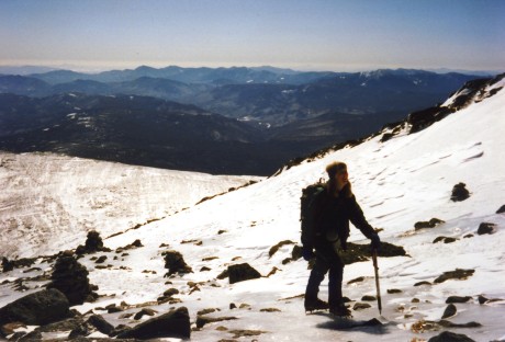
Winter hiking can actually be fun. We had a nice sunny day for this climb of Mt. Washington. No wind, and temps were above zero—not something you take for granted there in winter.
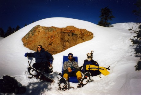
Conditions on a climb we did of Adams were really cold and windy.
We had “snow goblins” along the trail on a climb of Mt. Eisenhower.
Sometimes the trip was long hard work.
Oh, I forgot. This last one isn’t in the Whites. This is East Kennebago in western Maine—a bushwhack peak. I’m holding a moose horn we found.
Stay warm, and maybe spring will arrive one of these days!
Boteler Peak March 15, 2013
Posted by Jenny in conservation, hiking, Nantahala National Forest, Wilderness Society.Tags: Appalachian Trail, Boteler Peak, Chunky Gal trail, Lake Chatuge, thru-hikers, Tusquitee Bald
7 comments
This post is one of a series about “North Carolina’s Mountain Treasures,” lands targeted for higher protective designation by the Wilderness Society. For more information about this campaign, please visit the Mountain Treasures website. The review of management plans for Pisgah and Nantahala National Forests is now underway.
Boteler Peak (elev. 5010′) links the Tusquitee Bald/Fires Creek Rim area with the southern Nantahala mountains. The area contains significant old-growth acreage, although big portions of the lower elevations have been logged. It is known for outcrops of serpentine rocks and unusual combinations of plants in what are called the serpentine barrens.
Boteler is reached via the portion of the Chunky Gal trail that goes northwest from Glade Gap on US 64. When I set off to visit Boteler yesterday, the toughest challenge I met was finding the trailhead. If you are driving from Franklin NC, you’ll find it several miles west of the Macon – Clay county line. The best tactic is to look out for the top of a sustained climb, where you find a side road on the right marked “Old Hwy 64” just before the main highway drops down toward Hayesville. That is where you pull off. It is hard to spot the Forest Service marker from the highway.
After a false start on a gravel road just down the highway, I figured things out and set off along the dirt road where the trail starts. Following blue blazes, I dropped down into the valley of Glade Creek and started to climb along the stream. Total elevation gain was 1500′, and distance was about 6 miles roundtrip.
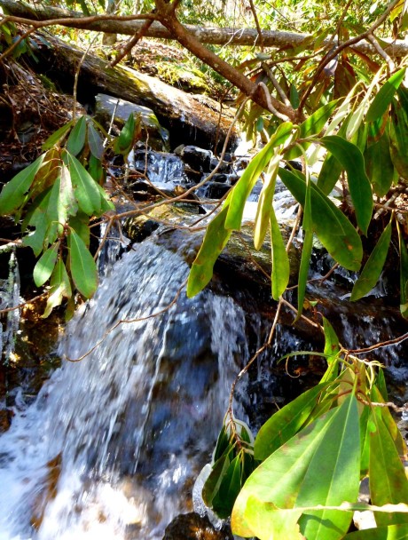
I crossed the stream at a pretty spot where rhodo overhung a small cascade.
The night before, temps got down into the teens at this elevation, and ice was hanging on even though it was now in the low 40s.
I figured it was too early for spring wildflowers above 3600′. (I spotted my first trout lilies of the year the other day at 3000′ in the Plotts.) So I looked for other forms of interest.
The trail reached an old Forest Service road and followed the road for a half mile or so. It is well-signed and easy to follow. (The Mountain High Hikers based in Young Harris, Georgia, maintain it.)
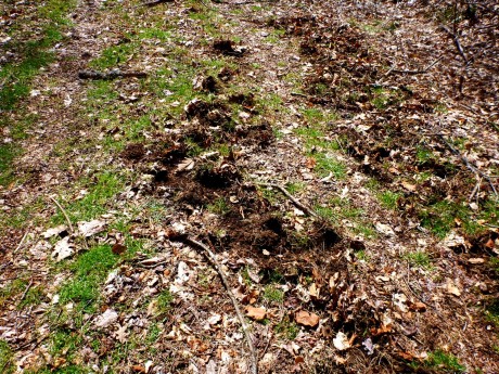
I’d heard that wild hogs are common in the area, and I saw their hoofprints and signs of rooting in several places.
At the point where the trail left the road again to climb along the ridge, I saw something that really startled me: balsams. I would never expect to see them as low as 4500′, nearly down at the Georgia line. Planted by stealth? Escapees from a Fraser fir plantation? Beats me.
A few more spindly ones appeared on the other side of the trail, and then they disappeared, replaced by the occasional unhealthy hemlock that one would expect.
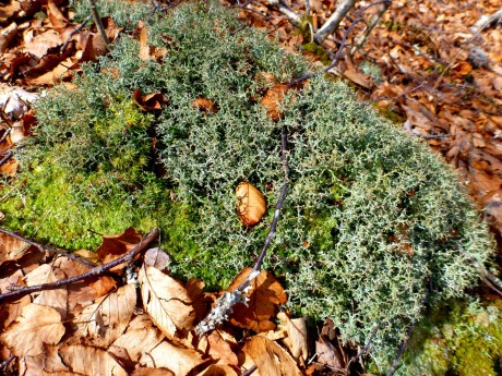
I passed a few more interesting specimens of plant life.
The trail stayed almost level for a while as it followed the ridge. It went through a series of rhodo tunnels.
As I climbed slightly higher, I entered a zone affected by wind and fog. Twisted oaks rose above the rhodo understory, their branches covered with the lichens and moss caused by long immersion in mist. Areas of severe wind damage had been tended to by the Mountain High Hikers: I saw stacks of rhodo blowdown laid neatly beside the trail. I passed a tree that had become a real mecca for woodpeckers.
After following the ridge without much change in elevation for quite a while, I passed what I thought might be the high point and dropped down. I’d heard of a side trail to a view, so I kept going. Apparently this side trail has been improved by the Mountain High Hikers in the past couple of years.
From that point I climbed another 150′, to what was the true high point, before I reached the dramatic viewpoint among yellow birches and low, huddled vegetation—perhaps the serpentine barrens? The best view was across to the Tusquitee range.
I liked the wind-stunted birches, but it was surprisingly chilly up there. I had two layers of fleece under my shell, plus my mittens. The sky had turned overcast. I could swear it was completely clear until I approached the summit and then cleared up again as soon as I left.
As I headed back down the side trail, I noticed an ancient laurel. Its trunk was massive.
I had glimpses of Chatuge Lake to the south (see photo at bottom).
The trip back to the trailhead went uneventfully. As I reached my car, another car pulled up and a man with a map stepped out. “Can you tell us where to find the Chunky Gal trail?” I pointed to the obscure Forest Service marker just a few yards away. It turned out he had a house near Tusquitee Bald and was scouting out the trailhead location for a weekend hike. I gave him some information about my trip to Boteler, and he thanked me profusely.
I got in my car and headed home toward Sylva. As I neared the A.T. crossing, I sped past three hitchhikers with large packs. I thought, “I can’t fit them into my small car!” and drove by. But a minute later I was turning around to pick them up. We’d figure out a way to squeeze everyone in. Sure enough, they were thru-hikers, and they’d had a tough day. Their water had frozen solid the previous night, and they’d gone quite a few miles without anything to drink. It had been a chilly day. They were headed into Franklin for some R&R and a “zero” day (a rest day with zero mileage). I was happy to take them to the place they planned to spend the night in downtown Franklin. “You made our day!” they said.
No, you made my day. It is such a pleasure to be able to help.


