Mt. LeConte via phone line route June 25, 2013
Posted by Jenny in bushwhacking, hiking, Smoky Mountains.Tags: Herrick Brown, Jack Huff, LeConte Creek, Mt. LeConte, phone line route, Smoky Mountains Hiking Club
13 comments

Two phone lines in this stretch!
Added 7/2/13: For further information about history of the phone line, visit this post.
Today I bushwhacked up LeConte Creek, which is the route of the old phone line that once connected a hand-cranked phone in a barn at what is now Rainbow Falls trailhead to a similar phone up top of the mountain. I hiked the trail as far as Rainbow Falls and then took to the stream.
You may notice a method to my madness recently. Let’s just say I’m nearly finished a project that I started casually many years ago, and I have only one more challenge to meet—but that will probably be the toughest of all.
Enough about me. Let’s look into the story behind this phone line. In 1926 Jack Huff started his project of building a retreat on the summit of LeConte. He kept building and adding and improving over the years, and eventually it became a precursor to the Lodge, and people went up there and slept in WWI-surplus army blankets atop fir boughs. Somewhere along the way he installed a phone on the summit—after all, it must be nice to connect with the lowlands every now and then. I don’t know when exactly the phone system was first installed.
One of the purposes of the phones was to coordinate the packhorse operations. Horses were housed in the Cherokee Orchard barn that no longer exists, and they would carry supplies up to the summit along what is now the Rainbow Falls trail. At some point within my experience of the Smokies, the decision was made to use llamas at the Trillium Gap trail instead—lower impact, less traveled trail.
In 1961 Herrick Brown took over the Lodge. He was a member of the Smoky Mountains Hiking Club, and other SMHC members had frequent communications with him. Readers of the wonderful book by Harvey Broome titled Out Under the Sky of the Great Smokies will recall a trip the club did in the early 60s, in deep snow in January, up the route of the phone line. They drove from Knoxville on snowy roads, slithering along the way, and when they got through to Cherokee Orchard they called Herrick from the barn to ask him about conditions. He said something along the lines of, “Deep snow! Come on up!”
Harvey described the tough time he had climbing through the snow with his heavy pack. He spoke of the complete solitude that one can experience in difficult conditions. The younger members of the club passed him as he took a step, rested, took another step. It is one of the most poignant passages of the book. I can only say, after my experience hiking today, that the idea of doing this climb in deep snow in January is fathomless to me.
I’ve read a description of following the phone line route that says it’s possible to pick it up below Rainbow Falls where a big rock sticks out of a muddy bank. I looked for a place that met that description and found a few too many possibilities. Anyway, I had little interest in following the lower portion of LeConte Creek as it follows close to the trail.
As I climbed the trail, I passed the spot where I came down with Greg Hoover and Greg Harrell on our Traverse of Balsam Point in May 2010—a pretty cascade.

We started at Ft. Harry Falls, went over Balsam Point, and came down here.
Not long after passing the Greg Cascade, I arrived at Rainbow Falls.

Rainbow Falls
The falls itself is, in my opinion, the only reason at all to use the eroded, ugly, overused trail that leads up to it, full of damp toilet paper and informal side-trails where people have cut the switchbacks. Sorry for the negativity.
I figured I’d take the trail around the falls to the lowest point where I could reasonably get to the stream. If you use the trail at all, you end up hitting the stream 100 feet or so above the falls. And that requires contouring around from the trail to the stream through dense rhodo. But I got there. I saw a pretty little cascade, but no sign of the phone line yet.

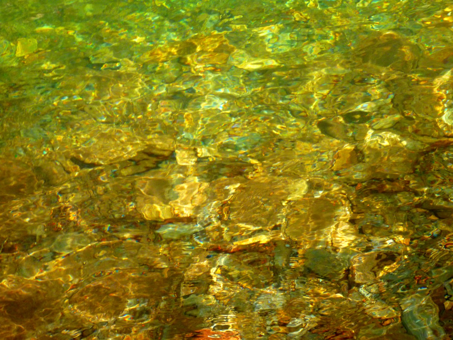
This is a very nice stream.
I still didn’t see the phone line. I now realize that it was virtually impossible to see unless it was right in the stream or right next to it. The vegetation is too thick. Perhaps others would have spotted it lower, but I finally found it at the junction of two branches of LeConte Creek at 4600′. You are guaranteed to see it there.

My first sight of the phone line.
I was relieved. It would have been embarrassing if I hadn’t seen it at all. Admittedly it is difficult under current conditions of vegetation to get up the stream in the first place while spending long hours hunting around for the phone line, but anyway. I found it, and kept seeing it on and off for the next 1000 vertical feet.

In this section the phone line goes straight up the stream.

Phone line up mossy rocks.

Two wires by a small waterfall.
Most of the time I saw newer wire that had some sort of coating to it (and when I say “new,” I mean “relatively new,” of course!). But here and there I found an older line that was thinner, and bare wire.

Older, thinner phone line.
It got harder and harder to find the line as I got up into forest of witch hobble and blackberry. But at least the stream was pretty.

Pretty waterfall.
It was around this point that a light rain began to fall. It only lasted for 15 or 20 minutes, but that was enough to get all of the brush thoroughly wet and of course me wet as well.

Blackberries in bloom over the stream.

Mossy cascade.
It was a world of water and vegetation. More and more, I believe the world of the Smokies has changed profoundly in recent decades, in ways that have big impacts on off-trail hikers. First of all, so many areas of the mountains were logged in the early 20th century. Of course I’m glad that has ended forever, but in the decades following the creation of the park, the vegetation must have taken a while to recover, making it easier for explorers to make their way through the forest in the mid-20th. Then, more recently, we’ve had devastation of first the balsam firs and then the hemlocks, resulting in numerous blowdowns. On top of that, the extraordinary levels of rainfall this year have resulted in even more blowdowns as trees in high winds and loose, wet soil can’t stay upright.
Perhaps this is only the way I rationalize my own slow pace over ground that the kids working at the Lodge in the 60s used to race over. They’d call up to the summit as they were starting so as to get an accurate measure of the time it took to run from Cherokee Orchard to the Lodge. (I don’t know what those times were, by the way—I’d be interested if anyone can tell me.)
I lucked out and didn’t run into any rhodo hells above about 4500′, but that great blackberry-witch hobble combo was a real pain above that. As much as I could, I stayed in the creek.
I did run into stretches of nice open forest, especially above 5500′.

Clouds alternated with sunshine for a while.
The Rainbow Falls trail crossed the stream at 5800′ and again at 6200′. I followed an increasingly small trickle of water and gave up the woods for the trail at the upper crossing.

Headwaters of LeConte Creek just below 6200′ trail crossing.
You can see fog on the lens here (and in the next photo). I was so wet and bedraggled at this point that a woman who passed me asked, “Are you okay?” Of course everyone I met near the Lodge was wearing clean, dry clothes—generally shorts and short-sleeved shirts—and I had my long-sleeved clothing, totally dirty and wet. Readers of my Surry Fork post may recall the strange feeling this gave me. But this time I resolved that I would recognize my own superiority 🙂 and no sense of oddness would disturb me. It was kind of funny when I was sitting on the swing at the Lodge and a man and his daughter passed me and he said, “See, she’s wearing gaiters, like I told you about.” I said, “I use them when I bushwhack,” but there was no question or curiosity at all on their part about what this entailed. I’ve decided that makes it even better.

I left a wet, dirty butt print on the swing when I departed.
After resting a bit, I headed down the Bullhead trail, a trail far superior to the Rainbow Falls trail.
All right, on to my final challenge!

Galax in bloom along Bullhead trail.
Stewartia walk June 21, 2013
Posted by Jenny in conservation, hiking, Nantahala National Forest, nature, plants.Tags: Fires Creek basin, Jack Johnston, Southern Appalachian Plant Society, Stewartia ovata, Wilderness Society
add a comment

Stewartia ovata. (Wikimedia photo.)

We saw buds, not flowers.
Many things didn’t go according to plan on this joint outing of the Southern Appalachian Plant Society and the Wilderness Society. Yet I learned much of interest from the leader of the walk, Jack Johnston, a naturalist who specializes in stewartia.
The obvious disappointment was that the stewartias forgot this year to bloom when they are supposed to—the summer solistice. Jack told us that the solstice bloom had been reliable for the past twenty years, but he warned the group that because of this year’s cold spring we might see buds fully closed or just barely starting to open.

Jack talks to the group.
Other things went wrong. The road we planned to drive into the Fires Creek basin near Hayesville, NC, was closed for construction, as we found after we’d nearly reached our destination. We then drove a long way around to bypass the closure and did manage to reach our starting point at the Leatherwood Falls picnic area. And when we proceeded on our hike to the point where we needed to wade across Fires Creek several times, we found that the stream was running too high and fast for a comfortable crossing. Only the first crossing was manageable for the group.
And then there was an awful lot of logistical confusion around shuttling cars and people to a point along a Forest Service road where we might approach stewartia locations from another direction.
Nevertheless.
Two things in particular interested me in Jack’s information. The first was that the root of a stewartia can be hundreds of years old. A main stem grows to an age of 80 or 100 years old and is replaced by a newer stem growing from the same root.

Old and new stem growing from same root.

Leaves of stewartia.
The other point I found especially interesting was the concept of canopy gap. Stewartias like to live on edges of streams, which form permanent gaps in the forest canopy. They like other gaps that let in light on one side, such as gaps formed by rock bluffs. A temporary canopy gap may be formed by a downed tree, but that gap will not persist in the long run as other vegetation grows in to fill the empty spot.
Stewartias frequently grow in the company of red maples, hemlocks, certain pines, sourwoods, and rhododendron. The bloom usually occurs at about the same time as the rosebay rhododendron. This rhododendron at least gave us something pretty to look at.

Rosebay bloom.
The first place we wanted to cross the creek worked out even though it was downstream of the other planned crossings because the stream was flowing at a flatter gradient at that point, therefore had slow-moving water.

The one successful stream crossing.
Fires Creek was simply running higher than normal this year. Rainfall in western NC to date in 2013 has been more than 16 inches above average levels.
We saw a deep pool that some members of our group have used as a swimming hole in hot weather.

The pool is about five feet deep in the middle.
Patterns of light in the pool.
We followed a Forest Service road as far as a bridge, looked at a possible wading spot a little downstream of that which could take us to our unmaintained pathway, and decided we didn’t like the look of it. At that point we opted to cut our losses and head back. But still, it was an outing worthwhile in certain respects.
The Fires Creek Basin is an area designated as one of North Carolina’s “Mountain Treasure” by the Wilderness Society, which is working to obtain higher levels of protection for these areas within the current revisions to management plans for Nantahala and Pisgah National Forests.

Fires Creek from the bridge.
Mt. LeConte via Surry Fork June 16, 2013
Posted by Jenny in bushwhacking, hiking, Smoky Mountains.Tags: Grotto Falls, Roaring Fork, Surry Fork, Trillium Gap trail
8 comments

Cascade on Surry Fork
This was a solo bushwhack that I undertook for several reasons. One of them was that I wanted to find out why Surry Fork has been so neglected among the streams that tumble down the slopes of LeConte. Perhaps it is upstaged by its neighbor, Roaring Fork, which is a larger stream with bigger waterfalls—I suppose you could say Roaring Fork is more deluxe than Surry.
Another reason for its neglect is no doubt the unfortunate circumstance that Surry Fork is crossed by the Trillium Gap trail a total of four times. To be more exact, the upper valley loses its perennial stream water by the time you get to the third trail crossing, but you still go across the trail as you follow that basic route.
So perhaps that is the reason the Smoky Mountains Hiking Club never goes up it and you never hear talk of Surry Fork among the usual off-trail hard-cores.
The 1931 map shows an old trail that goes up Surry Fork to Trillium Gap. Surry joins Roaring Fork above what is now the Roaring Fork Motor Nature Trail, and that is where you would be most likely to pick up the old trail. It’s maybe even an old road in that section that led up to former homesites.
I thought about starting from the lowest point, but I rejected that in favor of going up Trillium Gap trail past Grotto Falls and hitting Surry at the lowest trail crossing, around 4400′. Why, that’s halfway up the mountain, and you might consider that cheating. But I did it anyway. I also cheated a tiny bit at the top, as I will explain.
So I set off along the trail to Grotto Falls. For some reason on this trip I really noticed the bizarre patterns of exposed roots on the trail.

The roots are really quite striking once you pay attention to them.
I arrived at Grotto Falls. Here is my favorite perspective on the falls.

- Behind the falls.
Then I trundled along to the first crossing of Surry Fork. It looked extraordinarily green. The photo below has no enhancement of color. In fact, I turned the brightness down a bit.

Here is where I picked up Surry Fork.
Before long I reached a junction of two branches of Surry Fork. Only the left is shown on the map as a perennial stream, but to me they looked about equal in volume of water flow. Both had cascades flowing down over a band of sandstone that extended pretty far in both directions at that elevation.

I got a better perspective as I climbed up beside it.
I noticed that the rock is pockmarked with holes. I have noticed this in a few other places, such as Kuwahi Branch up near Clingmans Dome summit. I don’t know what the geological explanation is.

Pockmarks in rock.
I went over toward the left cascade, but the vegetation was incredibly dense and I needed to find a route up the cascade bluff. So this photo was taken from a distance. Sorry it is blurry.

The left and right cascades were like pages of an open book.
I crawled through a lot of rhodo getting up past this general elevation. I saw one—just one—blossom here as if the plant was making a conciliatory gesture. (I saw a lot more rhodo in bloom along roads and other places where you aren’t wrestling with it. Funny thing about that.)

I think the rhodo was making fun of me…

…because this is what it looked like most of the time.

The blackberry canes did the same thing.

Rhodo does come in handy for climbing up.

Higher up the rhodo didn’t look quite so spiffy.

Above 5800′ I finally got into balsam woods.
Unfortunately, I got into a zone of intensive balsam blowdown, from the trees that were killed from the balsam woolly adelgid in the late 80s and early 90s.

Balsam blowdown.
It was at this point that I cheated again. Thing was, I was ridiculously close to the trail—and this is really the problem with Surry Fork. As I clambered over one blowdown after another, I couldn’t forget the trail was literally only yards away from my route, located on the west side of the ridge that led up to the Lodge.
I threw in the towel and dropped down to the trail at about 6000′, climbed up to the Lodge, and then went on to Cliff Top because I wanted to see the myrtle in bloom.

Oh, the myrtle was beautiful!

Looking toward West Point.
I had hardly seen anyone all day (no big surprise there), but two young couples came up while I was sitting at Cliff Top. They asked me if I’d come up the Alum Cave trail. I was seized with a strange fit of awkwardness. I said I’d gone up past Grotto Falls and climbed up a stream, and I knew I couldn’t possibly explain it. They saw my dirty clothes, the fact that I was wearing long sleeves and long pants, dirty gaiters.
For some reason instead of seeing myself as a glorious explorer I could only see myself as kind of a weirdo, at least in their eyes. I had the same feeling when I got back down to Grotto Falls and ran into tons of tourists on the trail. It was uniformly family groups wearing t-shirts and shorts, and here I was, a solitary female who looked dirty and dressed differently than everyone else. I should have felt superior, I guess. Instead I only felt odd. Sorry for the deep psychological digression.
While I was up on Cliff Top, I saw a Rhodo minus in bud. It’s one of my favorite plants.

Rhodo minus next to myrtle.
And then I had to face up to the long trip down Trillium Gap trail. One nice thing happened—I saw a very tame deer near the Lodge!

That grass looks very tasty!

