Bent Arm Manway on a showery day April 27, 2015
Posted by Jenny in bushwhacking, hiking, nature, Smoky Mountains.Tags: Bent Arm manway, Dripping Springs Mountain, Elkmont, Jake's Creek trail, Miry Ridge, Smoky Mountains Hiking Club
8 comments

Snowy fields of fringed phacelia along the manway.
The forecast kept changing. Showers all day—rain in the morning followed by clearing—low probability of precipitation, or high—at any rate, I suspect the uncertainty kept some folks from joining our outing.
We had nine in our group, and it was a wonderful hike. We shared an enthusiasm for the remarkable plant life that thrived all along our route, and for the bird songs, the trees, and the history of this part of the Smokies.
As it turned out, we had intermittent showers throughout the day, but the temperature remained comfortable. And what is better on an April day than to observe swarms of wildflowers gleaming with shimmering raindrops?
As I drove over to Elkmont from the North Carolina side of the mountains, I enjoyed dramatic changes in the skies. Sometimes I drove through dense fog, and other times I observed a spotlight effect of sunlight coming through the clouds.

On my drive over—dramatic sky near Newfound Gap.
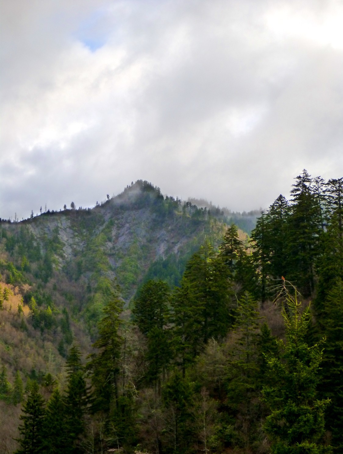
Beams of sunlight near Anakeesta Ridge.
As soon as we started on our way up the Jakes Creek trail, we were luxuriating in the lush cushions of wildflowers all around us.

Dwarf iris.

Showy orchis.
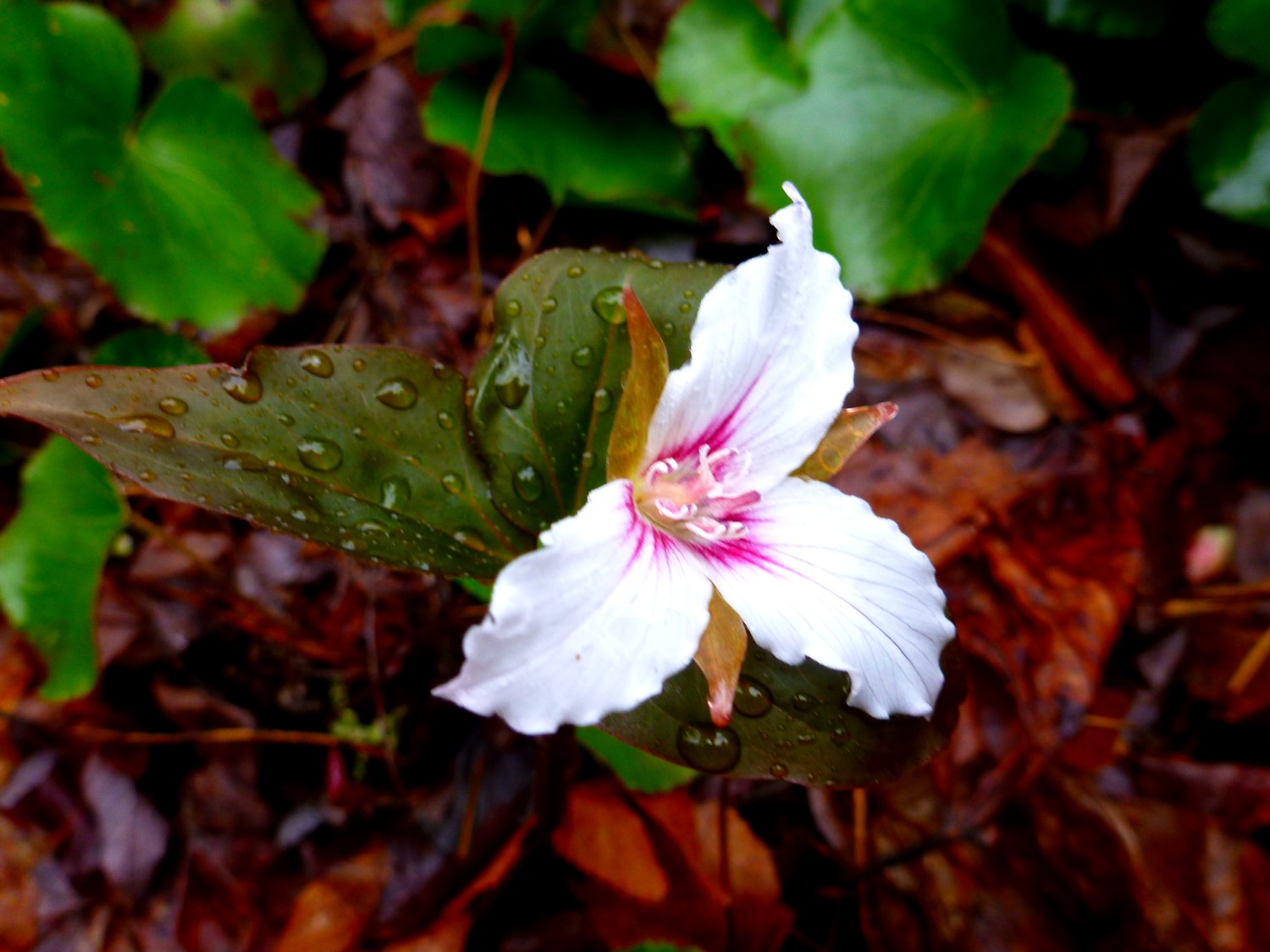
Painted trillium.
When we reached the Miry Ridge trail and climbed up to the distinctive open heath area, we debated whether to make that our lunch spot. It is an interesting place, full of laurel and galax and reindeer moss, but the fog had closed in and we had no views. We opted to continue to the backcountry campsite. Just as we stopped for lunch, it started to rain fairly heavily. I took a few photos that were blurred by the dampness.

Jim and Ken talk things over in the rain.

Hiram and Jean in their rain gear.

Michael Ray had a more sensible way of dealing with the rain.
We continued along, and I started looking for the manway where the trail reaches the crest of the ridge. But Michael, who has been on the manway six times, spotted the junction before I did. I had a momentary thought: “They’re going to think I don’t know how to follow the manway.” In reality, it all worked out perfectly. There are places where you can either stay on the ridgecrest or contour along the side. At times some of us went one way and some another, but our routes were always within sight or at most calling distance of each other. The general direction remained clear.
I found that the pathway was easier to follow at this time of year than when Ken and I scouted it. At that time, the forest floor was uniformly brown, covered with fallen leaves. But yesterday, the path was often clearly marked by the relative absence of vegetation on the path. Well, at least that was true in the grassy areas, where the grass does not grow in the path. When we came to the fringed phacelia, it grew exuberantly all across the footway.
Once you reach the sharp turn to the left where you see some CCC rockwork, the old trail becomes very clear and nearly impossible to lose. It’s just that you encounter considerable rhodo and doghobble in this section.
Eventually we reached a notable spot where a quartz rock is embedded in a tree. Members of the group had different theories about this. Some thought it was a boundary marker, while others thought it was the doing of the CCC folks.

Quartz embedded in tree.
It was a truly enjoyable outing with a great group of hikers who are all seriously interested in the marvelous natural offerings of the Smokies. I will soon have to leave this area, but I will be back for visits as often as I can.

We saw this somewhere along our journey—I won’t say when or where.
Hanging Rock State Park April 21, 2015
Posted by Jenny in hiking, nature, Southern Appalachians.Tags: Hanging Rock State Park, NC waterfalls, quartzite, Sauratown Mountains, Stokes County NC
12 comments

The famous hanging rock.
My friend Gary lives in the Raleigh-Durham area, and I live west of Asheville. We have made many trips back and forth, but this time we decided to meet somewhere in between. We settled on Hanging Rock State Park, north of Winston-Salem.
It is located in Stokes County near the town of Danbury and not far south of the Virginia border. The interesting rocks are the remnants of the Sauratown Mountains, an isolated range east of the main Blue Ridge complex. The Sauratown Mountains owe their continued geological existence to their being composed of tough, resistant quartzite.
I made a running joke out of the fact that they are not composed of granite. I’ve noticed that whenever people encounter a very tough and ancient-looking rock, they will often refer to it as granite. Actually, the quartzite is even prettier than granite, as it has streaks of white quartz running through it in all kinds of interesting patterns.
The weather forecast called for rain, but Gary and I decided to go ahead with the trip, especially since the park features waterfalls, which would be especially impressive after all the precipitation we’ve been having. And even though the website I looked at featured photos taken in crystal-clear weather, I ended up deciding that this was in fact a perfect day to visit Hanging Rock, enshrouded as it was with thick, atmospheric fog and featuring roaring waterfalls.
We met up at the Visitors Center, where the parking lot was nearly empty, and headed up the Hanging Rock trail. The rock gets its name because it actually overhangs the trail, but rather than making a technical climb up to it, you angle gently around to approach it from a more hospitable direction.

Looking up from below Hanging Rock.

I am enjoying myself in the fog and drizzle.
We came around to the upper rocks, which are populated by small, twisted pitch pines. They made me think of Japanese brush stroke paintings.

Beautiful and mysterious.

Looking down into the abyss.

The wind-sculpted pines disappear into the fog.
We returned to the Visitors Center and made the short hike to the Upper Cascade.

Approaching the Upper Cascade.

Plenty of water flow.

Colors of the spring forest.
Now we drove to the most famous of the Hanging Rock waterfalls, the Lower Cascade. At the trailhead, you are greeted by a sign with a friendly reminder of possible death.

Always good to keep in mind the possibility of death.
The Lower Cascade is truly remarkable, framed by dramatic rock formations.

A truly dramatic waterfall.

Gary admires the cascade.

You could scramble around to reach different viewpoints.

Plants cling to the cliffs.
Finally we returned to the cars and drove down to Walnut Cove to have lunch at a Mexican restaurant. A very pleasant outing, and worth the drive for both of us.

I believe this is a kind of myrtle, taller than the sand myrtle of the Smokies.
Smith Branch manway April 17, 2015
Posted by Jenny in bushwhacking, hiking, Smoky Mountains.Tags: CCC camp, Kephart Prong, manways, Richland Mountain, Smith Branch manway
7 comments

There were way too many of these.
Every year the unmaintained trails of the Smokies get harder to follow. Many of them are old CCC trails constructed in the 30s and 40s. For various reasons the Park Service has let them go. The Smith Branch trail connected the big CCC camp at Kephart Prong with the former Richland Mountain trail. The latter no longer exists, except for the upper section above the Grassy Branch junction which the Park Service has redesignated as the so-called Dry Sluice trail.
Just in the past two years, this manway has become harder to follow. I have created a very rough map to show the routes I discuss below.

Smith Branch routes.
As you all know, I don’t use a GPS, so the routes above are hand-drawn based on my noting of various landmarks with compass and altimeter along the way. I’ve put in a question mark at a particularly dubious area. The map above is the current USGS map, which does not show the Smith Branch manway. The 1949 map below does show what was then a trail, but it is so lacking in detail as to be practically useless.

Not a whole lot of help.
Two years ago Cindy McJunkin and I went up the manway to scout a route suggested by Al Watson. The idea was to go up Smith Branch and follow the Richland Mountain crest to another manway at Will Branch, and take that back down to the Luftee. We ended up coming down Shell Bark Branch instead of Will Branch, but that’s another story.
Cindy and I successfully followed the manway to point “V” on the upper map, where there is a sharp switchback to the left hidden by rhodo. We missed the switchback and continued straight up the stream along a faint path with pruning cuts that indicated others had been that way as well. (Route shown in red on upper map.) The path gradually faded out and we realized we’d strayed off the manway, but we just continued upward through open woods and arrived without any trouble exactly where we needed to be, the col between Point 4891 and Point 4768. Then we continued southeast along the Richland crest.
I went back on my own a couple of months after that to see if I could correctly follow the manway. I made exactly the same mistake going up—missed the switchback and continued up the creek. But this time, instead of heading down Richland Mountain, I followed the Smith manway back down from the col so that I could see exactly where it went. It’s easy to find where it hits the ridgetop, and the upper section is hard to lose, though you have blowdowns and rhodo to deal with. I managed to follow the manway all the way down to point “V” and finally saw where the switchback comes in.
So this month I invited Ken Wise to join me to go up the Smith manway and come back down the same way. I didn’t anticipate any serious problems. But… we did have problems!

The Oconaluftee running high.
We’ve been getting a lot of rain the past few days, and the Luftee was running high where we crossed it on the Kephart Prong bridge. We passed a group of hikers going up the trail, and they must have been startled to see us suddenly veer off the trail and head into the woods. We picked up the manway without any trouble near a hog trap and followed it around into the Smith Branch valley.
Here I made a dumb mistake. I knew we had to look out for a switchback before long, but I started looking too soon, and when I saw a herd path heading up to the left I thought it must be people shortcutting to the higher trail section. Wrong! After wandering a bit, we corrected our course and continued past some large new blowdowns until we reached this first switchback.
We continued along with just a few moments of hesitation to point “V”, which I easily recognized this time. The path was clear until we came to a big conglomeration of blowdowns—about the same scale as the one shown in the top photo—and there we lost the manway.
Shouldn’t be that hard, right? These old CCC trails don’t meander around aimlessly. They keep along the same course until they make a switchback, then continue along steadily in the new direction.
But we could not find it. Ken went down, I went up, we went backwards and forwards, and finally I suggested we just follow a nearby ridge up to the Richland crest. Point “W” on the map is where we lost the manway, and point “X” shows the ridge we followed. After a steep push to get onto the ridge, it was fairly easy going except for patches of briers. We followed a bear path and found something really strange—a beer can that had been punctured by bear teeth. Had the bear carried the beer in its jaws from some other point? Had someone brought the beer up there and left it on this obscure side ridge? A mystery.

Rock tripe on boulder along the side ridge.
Finally we reached the magnificent summit of Point 4891. You can see its breathtaking alpine characteristics.

Mighty summit of 4891.
From there it is an easy walk down to the col, provided you go in the correct direction. I was glad I took a compass bearing from the map, because it’s easy to get turned around up there.
It started raining as we had lunch. We layered up and eventually headed down the upper manway. We passed the large blowdown shown at top.

Ken on upper manway.
The going was easy enough that I could stop and enjoy the wildflowers.

Dutchman’s breeches.

Mayapple unfurling like an umbrella against the
rain.

Endless variety of leaf shapes.

Forest floor becomes carpeted with green.
We encountered the usual blowdowns but made good progress for a while.

Typical stretch of upper manway.
Then we got into rhodo, and we lost the manway again. Same deal: Ken went up and I went down, we went back and forth looking for it, and couldn’t find it. For lack of a better alternative, we kept heading in the same direction. We made a detour into a terrible brier thicket. It was about this time that Ken started joking that the sawbriers were making fun of us. Ha, ha!
(He later spoke in an email of “out-stretched welcoming arms of hundreds of over-friendly Smoky Mountain sawbriers.” Yes, that about sums it up.)
Eventually we headed straight down through a patch of open woods. We knew that if worst came to worst, we could just go down to Smith Branch and pick up the manway there. It’s this stretch on the map that has a question mark next to it, because I don’t know exactly the route we took.
After dropping down a few hundred feet, what d’you know, we found the manway again. Followed it onto a ridge, lost it, found it again. Now we were angling southwest and crossed a tributary of Smith.

A big grapevine overhangs the Smith Branch tributary.

Streamside trillium.
Eventually we came to a trail section just below point “W” and made our way down to point “V.” From here on out the going was pretty straightforward… just a lot of work dealing with the continuous blowdowns and overhanging rhodo. That sort of thing gets kinda old when you’ve been doing it all day.
We reached the CCC camp just as a heavy rain began to fall. An interesting excursion. I swear there’s a Bermuda triangle in there somewhere.

Stone structure from old CCC camp.

