Bartram Trail to Cheoah Bald April 25, 2012
Posted by Jenny in hiking, Nantahala National Forest.Tags: Appalachian Trail, Bartram Trail, Cheoah Bald, Nantahala Gorge
trackback
I did this hike on April 14 and just now found the time to write about it.
The Bartram Trail is a footpath that travels about 115 miles through north Georgia and North Carolina, named for botanist William Bartram, who explored the area between 1773 and 1777. His account of his experience, The Travels of William Bartram, was published in 1791 and remains in print. The North Carolina Bartram Trail Society was organized in 1977 and devoted many years building the NC portion of the trail within a corridor in Nantahala National Forest. It has now been completed. It features some elegant trail construction, such as this bridge that protects a steep sidehill section.
I did this 10-mile hike on a warm Sunday afternoon, getting a late start and not beginning the climb until 1:00. I started at an elevation of about 2000′ in Nantahala Gorge. The endpoint elevation on Cheoah’s summit is 5062′, but the actual amount of climbing turned out to be closer to 3400′ because of a couple of significant ups and downs.
Cheoah is the northern terminus of Bartram. The last time I set foot on its summit was in 1986 with the Smoky Mountains Hiking Club on a dual mission: to do trail work on the A.T. and to see Halley’s Comet. We camped out on the Bald and set our alarm watches for 4:00 a.m. for the best view of the comet, which was visible but partially obscured by haze. The A.T. reaches Cheoah in a longer distance than the Bartram trail, starting further north in the Gorge at Wesser and traveling up the infamous “Jump-up” and across Sassafras Gap.
Once I crossed the highway and the railroad tracks across from the Winding Stair trailhead, I was greeted by the not-so-pretty sight of a large burned area. I believe the scorched areas I saw along the way were part of a program of prescribed burns, though unplanned forest fires have also sprung up in the area during recent dry weather.
The burn and the high position of the sun in the sky contributed to an overly toasty sensation as I toiled up through switchbacks to get up the steep wall of the gorge. I realized that I had probably not brought enough water. And I’d neglected to carry my usual bottle of iodine tablets.
Beware of the luxuriant poison ivy all along the first section of the trail. It finally fades out above 3000′.
Once the trail reaches the rim, it traverses over to the valley of Ledbetter Creek. At the high point of the traverse, I saw my first ladyslippers of the season.
The trail then makes one of its discouraging descents. But a colorful spattering of wildflowers along the way softened the realization that this would be a tougher hike than I’d anticipated.
I arrived at Ledbetter Creek, which the trail crisscrosses for the next couple of miles, passing through rubbly areas and making numerous small climbs and descents.
I’ve become fixated with the patterns of light in streamwater.
The wildflowers continued their kaleidoscopic progression.
It amazed me how well various plants were coming back in the burned areas.
The area has been battered by ice storms as well as by fire. This devastation zone may date to the harsh winter of 2009-2010.
I saw a painted trillium, one of my favorite wildflowers.
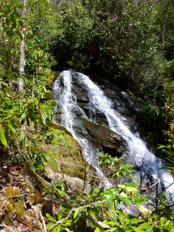
Three miles in, I reached Bartram Falls. It has a lower section and an upper section. The lower has the major drop of the waterfall, but the upper features some interesting sluiceways between large rectangular blocks of stone.
I entered a zone of Sweet White Trillium.
My water situation was looking grim to the point that I thought I might have to turn around. But I explored a bit and found a spring. I refilled my bottle here.
Not far above the spring, the trail crosses a forest service road and then tackles the steep climb up to the high ridge of the A.T. It runs beside a small stream drainage that was filled with the lush greenery of false hellebore.
At last I reached the junction with the A.T. and made the final push to the summit. I found two thru-hikers there—it’s so easy to spot them by their giant packs. We chatted for a bit and I enjoyed the view.
Be careful there, though. I spotted a tick crawling up my leg, and a day later found another one clinging to my earlobe—it had survived a hot shower!
It was time to face up to the trip back. An interesting hike of many contrasts and novel features. I highly recommend it—but start in the cool of the morning, not at 1:00.


Hi JB. My first backpacking trips (in the 1970s) were in the N GA mountains when I was living in Athens — Bartram, Cheoah, all of the AT in Georgia. Brings back fond memories just seeing the names in print (and the pictures).
Greg Hoover
Great post and love the photos. I’m afraid this is going to be a bad year for ticks with the mild winters most of us had. I had a couple on me the other day and that’s with me using bug spray to keep them down. Looks like an awesome trail. Keep up the good work and stay safe.
I’m curious about what the effects of the warm winter will be as the year goes on. So far, it looks like all of the plants are continuing to be several weeks ahead of schedule. Real topsy turvy weather we’re having—here in Sylva NC we’ve had hail, thunder, and downpours today!